
Paths, Pollinators and the Past
Linking the three P’s
Why Path, Pollinators and the Past?
Paths create links, not just for people, but for wildlife too, as wildflowers flourish along the margins. Paths also connect to the past: they might have been used by generations of people, follow and old drove road, or lead us to a hidden archaeological gem. The idea of CoSP taking an integrated approach ‘Path, Pollinators and the Past’ was the vision of Keith Graham.
With funding from National Lottery Awards for All and the Gibson Graham Charitable Trust, a workshop was held in October 2021 to share and connect knowledge held in the Carse communities, connect with national agencies in developing and implementing integrated projects embracing recreational access, history, archaeology and biodiversity.
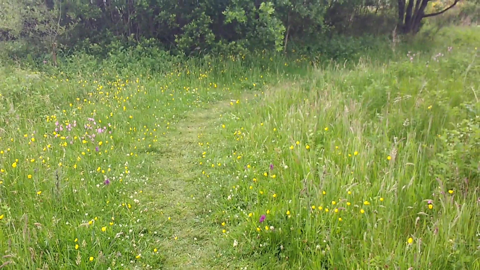
At the heart of this vision is the creation of pollinator corridors. These are essentially 50 metre wide ‘buffer strips’ of wildlife habitat on either side of new footpaths connecting our local villages. Quite apart from the amenity value of these walking routes, the net biodiversity gain will be vital for much of our local wildlife.
The need for action on pollinators
Although there are still thousands of species of pollinating insects in the UK, there has been a drastic decline and now over 250 species are threatened with extinction. Six of our 25 bumble bee species have declined at least 80% in the UK over the last 50 years. A higher proportion of bees fall into nationally scarce and vulnerable categories than any other insect group. 38% of hoverfly species are in decline, and 71% of butterfly species. Loss of habitat on which insects depend is one of the major causes of decline. In the last 100 years over 97% of flower-rich grassland in the UK has been lost, leaving the remaining habitat isolated and fragmented. Other causes of decline in our UK pollinators include pesticides and herbicides, particularly neonicotinoids (systemic pesticides), disease and parasites, such as from commercially reared honey bees and bumble bees released into the wider countryside.
B-Lines: pollinator highways
To try and drive forward practical work to support pollinators, environmental charity ‘Buglife’ initiated the ambitious B-lines project, which has been very successful in identifying exiting habitats and greenspaces and opportunities to link up key habitat for pollinators. Paths are linear by nature and connect places, so are prime candidates as B-lines. CoSP aim to contribute to the project by designing our path networks with pollinators in mind: not just by seeding wildflowers, but also by prioritising South-facing sites, focusing on local species and ensuring continuity.
Connections to the past
The history of the Carse of Stirling starts with the underlying geology. The Ochils are 400 million year old lava flows. The fault line is only between 40 and 100 million years old. The castle and Abbey Craig are 300 million year old extrusions. Remains of a whale found at Meiklewood, just north of Gargunnock, provide evidence of the Carse having previously been under water, when the skeleton was washed up from past seas. Excavations of 6000 year old oyster beds in the area provide further evidence of changing sea levels (and of climate change).
The strategic importance of Stirling and significance of the Carse is reflected in the fact that the only bridge shown on the first medieval map of Britain is that at Stirling. Medieval fortifications either side of the Carse such as on the Keir Hills are readily identifiable and accessible historic sites. Stirling is known worldwide for its castle, its association with William Wallace and famous battles such as Bannochburn but the Carse is also renowned for its significance during Scotland’s long history of cattle droving, all the routes from the North converging through the Carse on their way south. Between 1600 and 1850 it is estimated that over 100 million head of cattle passed through Stirling, many over Sheriffmuir – which is why it is now so fertile.
Other aspects of the Carse’s history are equally fascinating, including men and women being paid to clear peat, which was so deep that houses could be carved out of it. Local poet Charlie Gracie captures the environmental devastation as well as the tough life lived by the “moss lairds”.
Opportunities to highlight the history include interpretation boards along paths using QR codes to link to online information and a shared community calendar for events such as apple days or archaeological digs.
The PPP Project
During the workshop, other sites that lend themselves to the integrated approach connecting paths, biodiversity and history included:
Gargunnock Burn: opportunity to raise awareness of the geology of the Carse; Cessintully burn and reservoir at Thornhill, which used to feed the mill, now very biodiverse; 15th century fortified motte south of Kelty Burn; Inchmahome Priory, Lake of Monteith; the Roman fort west of Lake of Monteith; a cup and ring-marked stone south-west of Lake of Monteith; Falls of Frew; various Duns and forts marked on OS 1:50k OS Landranger map; the Cairn at Stronend on the Fintry hills; the Cemetery west of Blair Drummond; and the Fort south-west of Fintry. Clearly there are many more fascinating stories, sites and features of interest around the Carse and CoSP encourages local communities to identify those within its own area and links with other communities.
As next steps, CoSP would like to establish a pilot project to highlight and showcase the proposed integrated approach; to develop the shared community calendar to strengthen links between Carse communities; to promote new and existing paths through external websites; to lobby for active travel infrastructure; to estabilsh a canoe trail; to develop an integrated GIS map, and to connect more widely with existing strategies such as Stirling Council’s pollinator strategy.


